 |
||||||||||||
 |
 |
|||||||||||
 |
||||||||||||
 |
||||||||||||
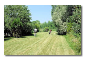
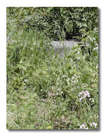
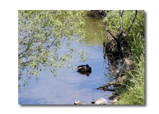
This path begins 100 metres north of Plante Drive and McCarthy Road, right across the street from the ‘alternate entrance’ described in Walk 5. The entrances (both east and west) are marked by the city with the bicycle/pedestrian bars. This path travels behind many backyards, and is very colourful. There are a few small paths leading off it that are fun to explore for the interesting flora, and because the area is home to a number of deer. |
||||||||||||
 |
||||||||||||
| The path goes east, past the last of the back yards to the south. | ||||||||||||
 |
||||||||||||
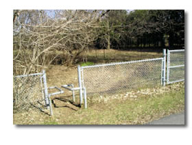
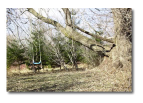
| People have beautified some of these areas through plantings, birdfeeders and even an old swing set and tire swing. | ||||||||||||
 |
||||||||||||
| The walk from here to the other side of the Airport Parkway is physically challenging | ||||||||||||
 |
||||||||||||
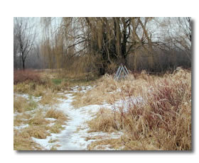
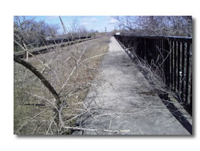
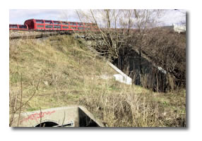
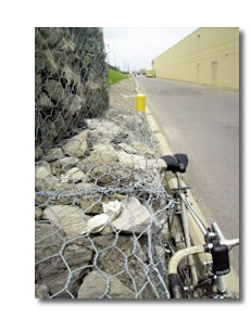
| The last 100 meters of the path can sometimes be a little overgrown as you approach the Airport Parkway. When you reach the Parkway, the best way to cross is to walk north to the railway bridge. Walk along the shoulder of the Airport Parkway and then walk up the steep stone and concrete reinforced hill. There is a sidewalk at the top for pedestrians, but it is very rarely used. | ||||||||||||
| (Bridge in spring and in summer) | ||||||||||||
 |
 |
|||||||||||
 |
||||||||||||
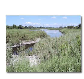
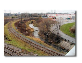
This sidewalk will take you across to the watershed park and its lovely new recreational paths. Getting from these ponds to Bank Street requires crossing some major obstructions. You need to cross the railway tracks and the bus trench. We hope that one day the Poets’ Pathway will cross along Sawmill Creek to the north, at Home Depot on Bank Street. Presently you can only cross these obstructions by going to the south. Turn right off the bridge. Walk through the light underbrush. Continue walking north. After 100 meters you will be given a choice of walking around the ponds on the east side or the west. Turn left here and take the walk along the east side, as it is further away from the Parkway. |
||||||||||||
 |
Note on the Ponds: The purpose of the ponds is to divert ground water away from residential and commercial areas. City signs describe the natural filtration of these ponds. These ponds are responsible for a natural ecology which has encouraged and preserved wild life- many birds and water plants. | |||||||||||
 |
||||||||||||
 |
||||||||||||
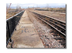
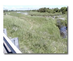
| When you reach the southern tip of the first of the ponds, before the path continues its circuit to the north, you will find the underpass that provides access across the obstructions to Bank Street. There should be a well-worn footpath visible, but keep an eye out for the red, glassed bus shelters of South Keys bus terminal. | ||||||||||||
 |
||||||||||||
After you go through the underpass, turn right, and walk up the short, steep hill and step over the concrete barrier. Turn right and take the stairs or the elevator to the tunnel that takes you under the bus trench and to the back of the South Keys shopping mall. Turn left and walk along the back of the mall, keeping your attention to the green embankment to your left, and not the warehouse-like building to your right. |
||||||||||||
 |
||||||||||||
| When you get to the end of the mall, follow the road out to Bank Street and turn left. Follow either the western sidewalk for a view of the ponds and Sawmill Creek… | ||||||||||||
 |
||||||||||||
 |
... or the sidewalk in the middle, for what remains of the green space that is here the Poets’ Pathway! | |||||||||||
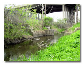
| Once on the other side of the bridge, cross to the east side and turn right on Ledbury Avenue, until you arrive at Sawmill Creek. | ||||||||||||
 |
||||||||||||
| This is the end of this walk. | ||||||||||||